GPNDG
Great Pacific Northwest
Dryside Gather ™
Great Pacific Northwest
Dryside Gather ™

The 26th Annual GPNDG
August 18-22, 2017
Crescent Lake, OR
August 18-22, 2017
Crescent Lake, OR
Google Maps: 43.492736, -121.962605
or N 43° 29' 34" — W 121° 57' 34"
Map to the 26th GPNDG
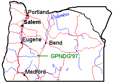
Here's a map of the State of Oregon showing the general location.
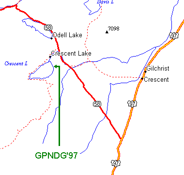
And here's a more localized map of the Crescent Lake area
with Oregon Highway 58, and US Highway 97 marked.
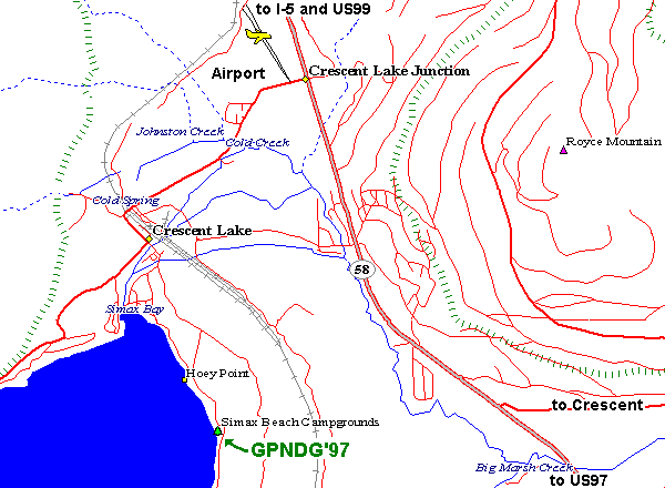
Here's a very detailed map from 1977 showing the main routes into the site,
and includes the location of the Airport (for Lissa's benefit).
Directions from Crescent, OR on US97:
| 12.2 | miles west on Road 61 |
| 3.5 | miles north on Hwy 58 |
| 2.2 | miles west on Road 60 |
| 1 | mile south on Road 6005 |
Distances from various cities and countries:
| 461 miles — | Spokane, WA |
| 358 miles — | Seattle, WA |
| 185 miles — | Portland, OR |
| 74 miles — | Bend, OR |
| 78 miles — | Eugene, OR |
| 100 miles — | Klamath Falls, OR |
| 171 miles — | Weed, CA |
| 359 miles — | Reno, NV |
| 488 miles — | San Jose, CA |
| 898 miles — | Escondido, CA |
| 1,106 miles — | Calgary, Alberta |
| 2,398 miles — | Columbus, OH |
Note: these milages are for the most direct (and probably boring) routes...