![[GPNDG]](/New-gpndg.gif)
|

|
|
The 20th Annual GPNDG
August 18-21, 2011 Eagle Lake, CA (Lassen National Forest) N 40° 32.831' — W 120° 47.262' |
| Site • Crew • Maps • Register • Activities • Rules • Who's Signed Up? • Rides |
Maps to the GPNDG!
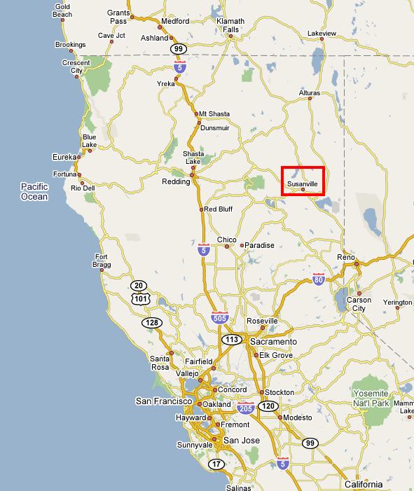
Here's a map northern California showing the general location north of Susanville.
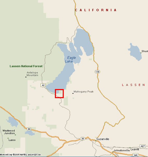
Eagle Lake, showing it's relationship to Susanville, US-395, CA-139 and CA-44.
View Eagle Campground in a larger map
Directions from Susanville, CA
Short way:
3 miles west on Hwy 36 13 miles north on County Road A-1 (Eagle Lake Rd) Long way:
31 miles north on Hwy 139 21 miles SE on County Road A-1 (Eagle Lake Rd)
Susanville is a small northern california town of about 14,000 residents with all the services you'd expect. Plenty of fuel, food, camping supplies, etc. Lots of fine motorcycling roads, too. It's the place you'll want to go for fuel and supplies, if only for the nice ride there and back.
Distances from various other places:
[Estimates from Delorme Map'n'Go using FASTEST route]
| 102 miles — | Reno, NV |
| 281 miles — | San Francisco, CA |
| 502 miles — | Portland, OR |
| 675 miles — | Seattle, WA |
| 684 miles — | Spokane, WA |
| 735 miles — | Escondido, CA |
| 1,069 miles — | Ft. Collins, CO |
| 1,119 miles — | Calgary, Alberta |
| 2,332 miles — | Columbus, OH |
| 2,822 miles — | Gainsville, FL |
| 7,600 miles — | Sydney, Australia (approx.) |
Link back to GPNDG 2011 page...